Tourist Photographer at Golden Gate
When you visit a location that is a mecca for visitors, and when there are such a limited number of vantage point locations and route of exploration, you feel like a tourist and not a photographer charting some new path and looking at something from a different angle. But you try!
This is how I felt on a trip to the Golden Gate Bridge in San Francisco, California. And I was very much a tourist because I live in Southern California near Los Angeles. And I was definitely taking photos from locations where thousands of photographers have taken very similar photos. Unless you are on a boat, using a drone, or climbing the bridge towers, the vantage points will all be roughly the same. I also have been there before, and taken photos from some of the same spots.
Why go back, and why stand in these same locations and snap away? It is truly one of the most beautiful and awe-inspiring locations on the west coast of the US, and its a great place for short hikes with various views of the ocean, bay, and city.
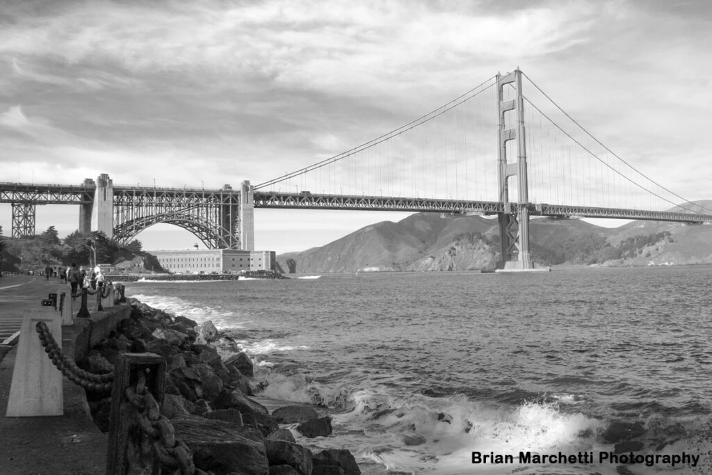
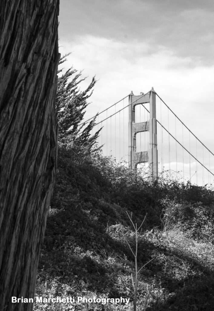
The detailed sky lent well to black and white, so I post-processed from a color photo.
keep that shutter going as you find different vantage points.
Fitting in a Visit to Golden Gate
This is a spot I love in California. Its a six-hour+ drive from my house near Los Angeles, so I don’t get to do this often. I take trips once a year of so to see my sister and her family and to explore the city over multiple days. Some travel tips….. The city is easy to get around in, but yes when society is running normally (not under COVID restrictions) there is a lot of street traffic. So there are a lot of bus/trolley options and Uber/Lyft pick-ups are always easy to get to. The BART regional train system is not affected by traffic, and is good for longer trips from the airport, down the peninsula, or across the Bay. CalTrain is a commuter style rail option from San Jose to San Francisco and cities in between. Having a car during a trip can be expensive, in terms of parking fees, so there are options from nearby cities and the airports.
is visible from everywhere.
What’s the Big Deal?
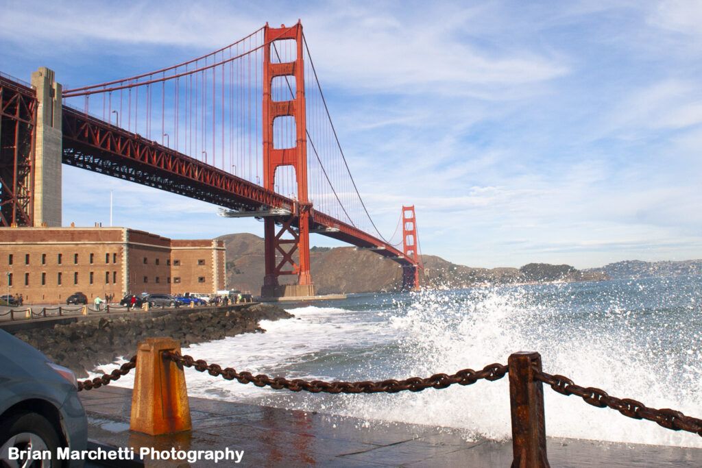
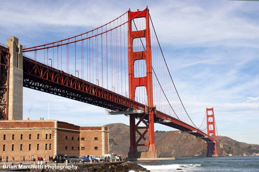
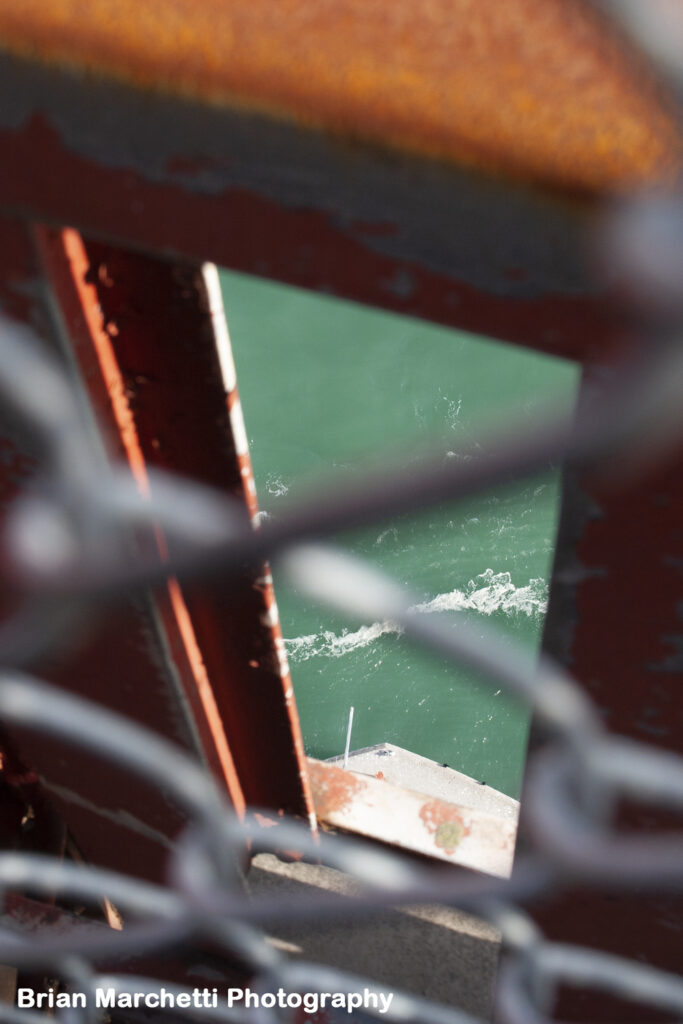
So what are other reasons, besides taking a scenic photographic, that make this point so interesting? This is the entrance to San Francisco Bay, which is a gigantic body of water that laps against Sausalito and the edges of wine country on the north, Berkeley and Oakland and its port on the east, and the peninsula cities and East Bay cities on the south. There is a also a ship channel out to Stockton in the Central Valley, which is xx miles from this point. So cargo ships go and in and out here and access the open ocean. You will often see large ships coming in that almost seem to touch the bottom of the bridge, but they have plenty of room. So this transportation element adds a lot of energy to the area, with a lot of cargo and tour ships going in and out. The currents are strong here, and ships are battling strong currents as they pass under the bridge and its towers.
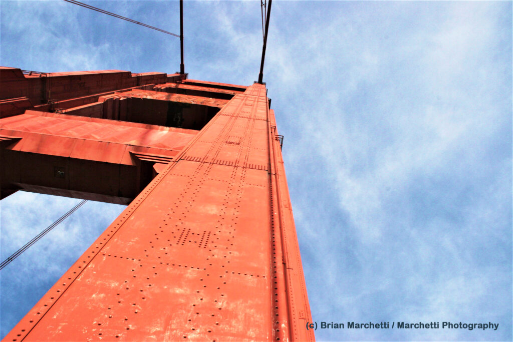
The bridge is truly beautiful in and of itself. It was built in the 1930s, when Art Deco design was in vogue – a very decorative and elaborate design movement. The bold red/orange color of the bridge was to be the first coat, but it caught on with the people during construction and the typical coat of grey paint was not applied as the final coating.
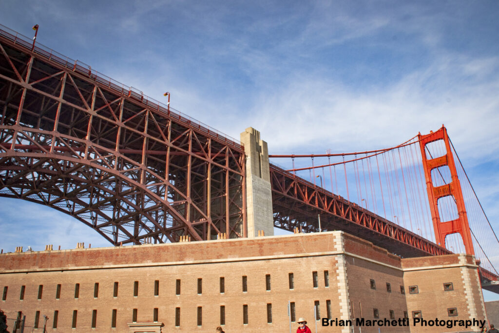
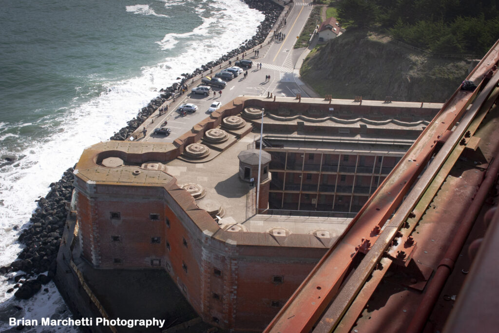
The brick building near the south tower, on the San Francisco side of the bridge, and where I took these photos, dates from the US Civil War era. It was a fort to protect the bay from foreign intruders (or the South and its big navy? Who knows…..) The land there is literally called Fort Point. The fort building was admired for its masonry by the bridge designers, and the archway at the south end of the bridge was included to save the fort from distruction.
There was fear of building a bridge here, when plans were announced, that it would destroy the natural beauty of the area and block views of the ocean. Its amazing to think of this area without the iconic bridge, but it seems that the outcome has been positive and its one of the main symbols of the city.
leaving it intact as a historic monument.

archway that steps over the building. Access is closed at other sides of the fort.
base of the south bridge tower.
Getting to Golden Gate
When you are along the Fisherman’s Wharf (waterfront) in San Francisco, you see the Golden Gate and picture it being an OK walk there and back. But then after walking around all other areas of city day after day (love that, but its tiring), you realize its a few miles west out to the Golden Gate. So sometimes parking a car there is key – this is what I found from my last trip.
You can get to parking areas near the bridge via local streets or from the US-101, but you have to keep your eyes open before the bridge. Of course, Uber and Lyft are great options for busy weekends and holidays when everyone will be at the bridge.
From in town in San Francisco, here is a good route. Take the US-101 (which is also Van Ness Street, a major north-south street in the City). north toward the Golden Gate bridge.
– Watch for the “Last SF Exit” sign, which also says “View Area, Presidio”, or you are going over the Golden Gate Bridge to Sausalito!
– Take that ramp to the right, turn right then left onto Lincoln Boulevard.
Battery East Parking Lot is on the left around curve
– You can park closer to the base of the bridge using Long Avenue, but you are getting into higher pedestrian/bicycle travel areas on that route, and the hike down to the base of bridge at Fort Point or the hike over to the bridge sidewalk is scenic and enjoyable.
– It is a climb coming back on the trail from Fort Point, but not terribly hard.
of the bridge and the ever-changing weather. Could be fog any minute!

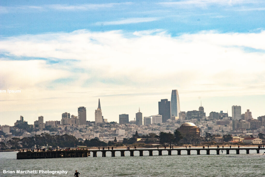
from Fisherman’s Wharf near Pier 45, at twilight.